
 |
| Moukhtara Valley, looking south |
I went hiking this weekend. Spring is the high season for
hiking here; both weather and nature are at their best. A Dutch friend
organized a guide and a bus (otherwise you’ve got to walk a loop), and we went
to explore the Barouk River Valley, which is actually called the Moukhtara
Valley, although Barouk River Valley would have made more sense to me, if it
weren’t for the fact that my MapMyHike app actually
calls it the Awali Rivier. What’s in a name?

 |
| Awali River, better known as the Barouk River |
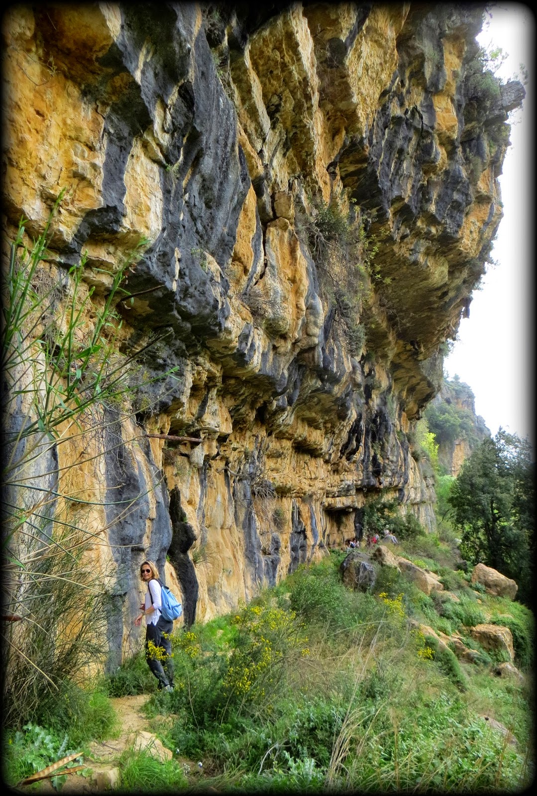
But the funnest part is when you leave that trail and
join an old Roman path that runs under a cliff alongside the river. There are
some remains of a Roman temple there at the end of the trail apparently. Not
sure how they know its Roman, because even before there were Romans, people
must have used some type of trail to move through the valley.
In Europe, there is an entire network of ancient
footpaths like these. The French have maintained, marked and mapped some
180,000 kilometers of them in their country alone. They’re called Grand Routes
(GR) and
these are the old roads that people used when moving across country or
continent. The paths are narrow and go from village to village, because in the
old days you either walked, or walked with a donkey (or horse, if you had
money), so no need for wide roads, and you needed villages for safety, food and
shelter.

It would be great if one day all these ancient footpaths
in Lebanon (and the region) would be mapped and marked. I know there is a long
distance path that runs from Turkey all the way through Syria and Jordan to the
Sinai desert, the Abraham Path. The
region is teeming with old trade routes and pilgrimage trails that are no
longer in use.
I have noticed that lately people have started to mark
trails; a good sign. The Barouk River Trail is marked by a single white band,
painted upon tree trunks or rocks. The LMT (Lebanon Mountain trail)
is marked with a purple and white band. They do the same in France where you
can walk from north to south, simply following a path marked by red and white
stripe.


This ‘Roman’ path runs all along a steep cliff on both
sides; one is a cliff wall going up, the other side is a cliff wall going down,
in some parts rather gradually, in other parts rather steep. A fellow Dutchie,
and avid hiker, broke her leg a couple of months ago while hiking along another
trail. I am not sure how they got her off the trail, but in this particular
place, the Red Cross guys are not going to be very happy with you of they need
to haul you out. In some parts you have to skip a little stream, or hike under
a waterfall; it’s all quite pretty.

That was part of my weekend. The next holiday is around
the corner, so will do some more hiking.
8 comments:
Absolutely beautiful pictures that reflect why Lebanon was called Lubnan El Akhdar or Green Lebanon.
Thank you for posting them !
to Anonymous ,those valleys exist in a lot of places, a lot of other countries and even better too ,Lebs just take pride because they've got nothing else
To anonymous above, did not know this was a post about comparing Lebanon's beauty to that of other countries, but your condescending comment says much.
Ohhh Pleaase anonymous ,don't start talking about the same old marketing tips :p,i appreciate the author's posts abt Lebanon ,abt talking abt happy things ,but all blogs are full of these ,the happy small pictures of The BIG bad picture of Lebanon,so please it's to fix the rest of the image ,instead of focusing on 1 % of beauty in it .Then again ,i appreciate the author's posts but enough is enough .Leb is not that beautiful that they market
If you really appreciate the author's post, you would not be complaining.
The Image of Lebanon is mainly an image of negativity, throughout the world. Instead of pointing fingers at who's fault it is. Let's appreciate this author's positive posts and positive images without trying to find negativity in everything.
hehhe i always appreciate her posts ,it seems the " wrong " and fake image of positivity of Leb is going to stay forever ,because theres almost nothing beautiful abt Leb anddd pleaase im noot nagging ,im telling the truth and will keep telling the truth
To still anonymous ,we are tired of the fake advertising and marketing that Leb is beautiful and it's not
Ohhh and another thing ,i never pointed finger to anyone ,whose fault it is ,read well my comment ,a typical Lebooo replies like that ,typical ,same pple ,you never grow up
Post a Comment